Walks in Maribyrnong City Council
There are so many wonderful walks to do in this thriving, inner-west area of Melbourne!
Maribyrnong City Council begins on the west banks of the Maribyrnong River and encompasses the suburbs of Yarraville, Footscray, West Footscray, Seddon, Tottenham, Kingsville, Maidstone, Maribyrnong and Braybrook.
Try the walks below to discover the diverse green spaces Maribyrnong has to offer. Click on the walk name to see a digital map, including route description and photos.
Cruickshank Park loop walk, 3.2km loop
This leafy loop walk in Yarraville follows Stony Creek upstream and down as it runs through the popular Cruickshank Park. There are many different things to do and places to stop for peace and quiet.
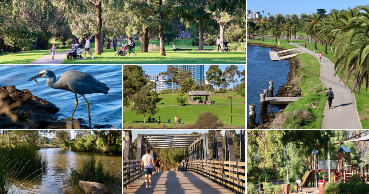
Footscray Park riverside loop walk, 3.5km loop
Enjoy the Edwardian jewel in Maribyrnong City's crown from both sides of Maribyrnong River - Footscray Park. This walk crosses the river twice to view the Park from within as well as across the water.
Footscray Wharf riverside loop walk, 2.9km loop
Footscray Wharf has been recreated as a quality riverside walking and recreation space. You can easily make it a loop by crossing the bridges over the Maribyrnong River at either end.
Newell's Paddock / Riverside Park loop walk, 2.4km loop
This captivating river crossing loop walk takes you into two opposite reserves. One is a bushy wetland refuge for wildlife and the other an open green space.
Cranwell Park Maribrynong River walk, 5.3km loop
From the attractively terraced Cranwell Park, wind your way to the Maribyrnong River for a beautiful bushland walk. The views along the river are gorgeous.
To discover more great walks in this part of Melbourne, head to this page (or visit the Walking Maps discover page and search by suburb or postcode).
Maribyrnong City Council enaged Victoria Walks to create these digital Walking Maps in 2023-2024. For more information on this service please see this page.